Some notes about Drewsteignton during the Eighteenth Century
By Paul Greener
A general description of the parish
Drewsteignton lies halfway along the old road between Exeter and Okehampton and this road used to mark most of the northern boundary of the ancient parish between Crockernwell and Whiddon Down. The River Teign still forms the southern boundary and streams outline the rest. Rising from 300 feet above sea level in the East to 600 feet in the West, where there are granite outcrops near the river, the old parish covered nearly 700 acres of good agricultural land.
A limestone ridge running east/west through the centre of the parish had been quarried for at least three centuries and in some places minerals such as tin and copper had been mined. The village which had grown up around the church, marked + on the map, is still the principal settlement and there was a hamlet at Crockernwell. The map shows isolated farms in the rest of the parish.
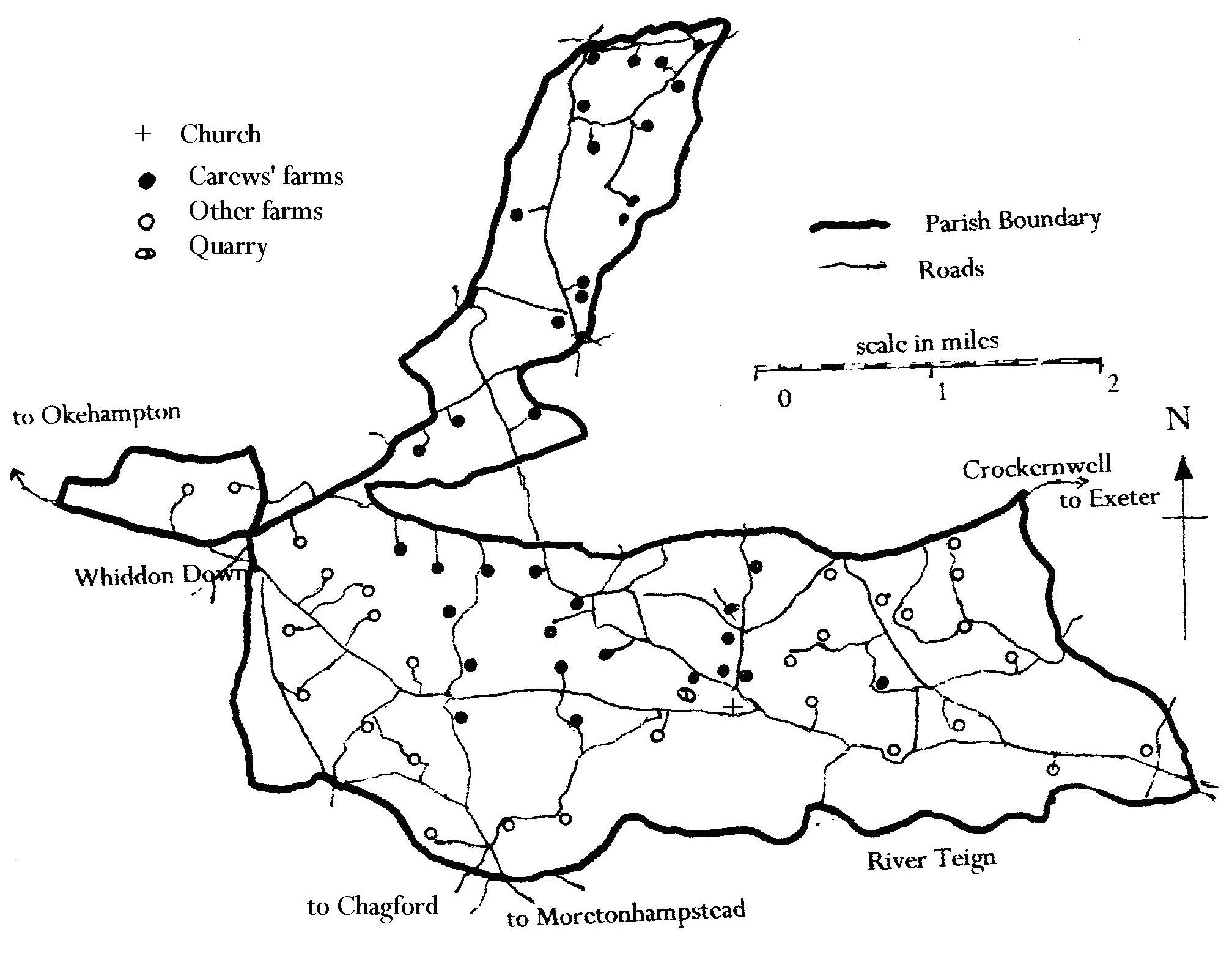
The Carew holdings shown on the map are identified from their manorial survey of 1685.1
Various members of this family, originally of Antony in Cornwall, had inherited, through profitable marriages, at least a third of the parish but there is no record of any of them ever living here. In practice the Rector was the most influential person in the parish since his responsibilities were both ecclesiastical and, in effect, civil. The living was one of the best in the Diocese with 440 acres of glebe and a valuable tithe so it was not difficult to attract good incumbents and an impression of these men can be gained by reading their replies to Bishops' visitation questions and by the way in which they kept parish registers.2
Continue to next section Return to contents